The Guadalupe De Los Reyes project is located in the western side of the Sierra Madre Occidental Province, a late Cretaceous to Tertiary age volcanic sequence that extends for hundreds of kilometers from the Neo-Volcanic Belt in Central Mexico to the Basin and Range Province in the north part of the country. This geologic province encloses a great number of major gold and silver deposits of historic production within mining districts of world importance, such as Hostotipaquillo, Bolaños, Guanajuato, La Ciénega, Tayoltita, Guadalupe de los Reyes, Topia, Batopilas, Dolores, etc.
The Guadalupe area is enclosed by an east-southeast trending mineralized structure that extends over 2.5 km and is up to 100 m in width. It is composed of two main veins, Guadalupe and San Manuel, with stockwork and numerous quartz veinlets in between. The Guadalupe Mine zone was developed by underground methods to a depth of about 400 m and along a strike length of approximately 1000 m. Historic recorded production for the mine was estimated at 875,000 t, comprising over 70% of the district’s recorded gold production.
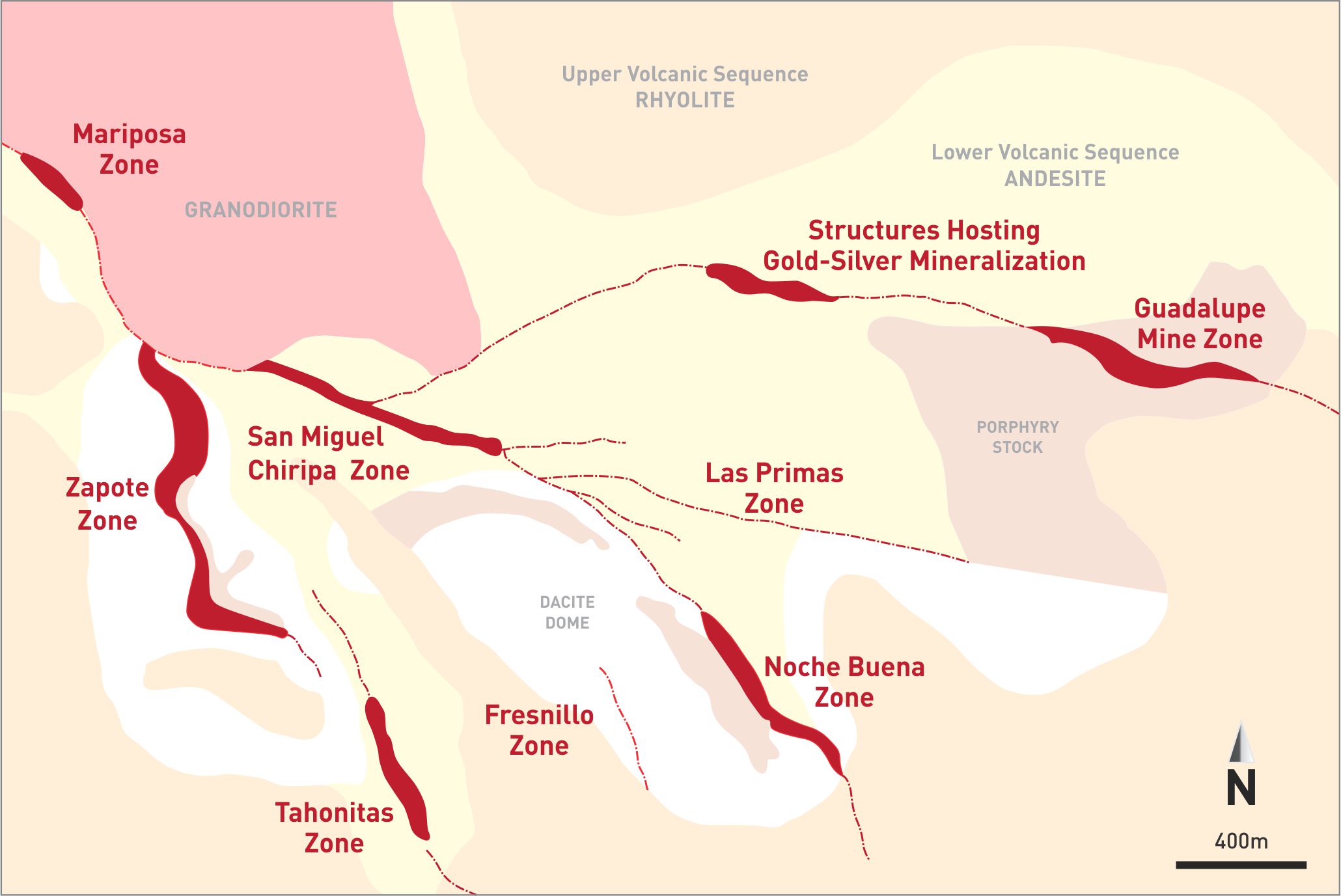
Mineralization in the project area has been found along a series of northwesterly trending structural zones in Tertiary-aged andesites, ranging from a few meters to several tens of meters in thickness. The mineralization is typical of low sulfidation epithermal systems consisting of quartz-adularia veins and stockwork zones. Gold occurs as microscopic-sized, free to quartz-encapsulated particles associated with silver. Pyrite content within the deposit is generally less than 1.0%. Since the gold does not occur in pyrite, oxidation of the pyrite does not appear to be a major factor in metallurgical gold liberation and recovery. The silver to gold ratio varies between the deposits but averages approximately 15:1 based on total silver to total gold.